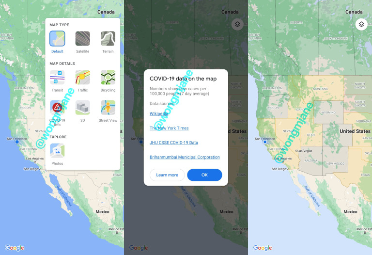
A few days back Google and Apple made clear that they will be integrating the detection technology for Covid-19 without the use of a specific app. Tech companies like Google have been trying to develop technology that could make the detection much easier and also help people to avoid areas through which the spread of the virus can be contained. In an effort to make detection technology for Covid-19 better, Google is now trying to prepare a new map specifically for Covid-19 which shows the area affected by the virus.
Also, the user will be able to differentiate between the areas being hit the hardest and areas which are still better in the containing of the virus. The new preview of the feature will work alongside transit, traffic, biking, 3D, and Street View and is simply titled “COVID-19”. The feature is being experimented in the US and the feature shows distinct lines between the states highlighting the states with a unique color where the number of cases is much more. It was found that Google is currently using the data of the New York Times, Wikipedia, John Hopkins University, and Brihanmumbai Municipal Corporation to identify the number of cases and spread of the virus in a specific state.
It is unclear if the feature is only meant for US or global use, but currently, the feature is in the experimental stage and only designed for the US. Once the feature has been completely designed, it will be interesting to see Google using this feature globally.
